THE APPS
Free Dipper apps.
Measure land with Area Measure. Record site work with Dipper Field. Find planned points with Dipper Layout. Field and Layout are in development.

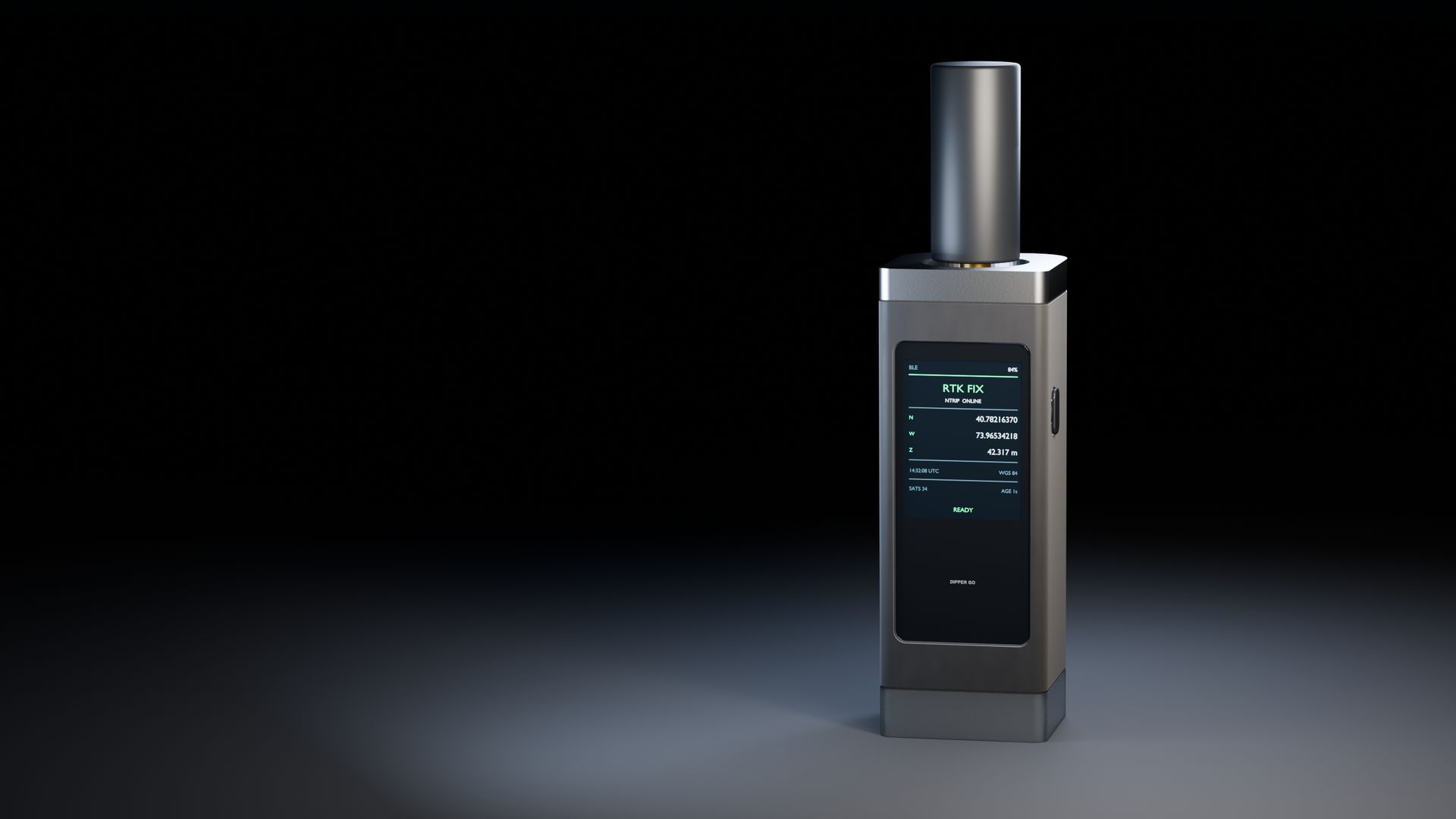
A handheld RTK GPS receiver that gives your phone precise positions for mapping, layout, field data collection, and land measurement.
Free apps. Built-in RTK. Your choice of correction service.
This device has not been authorized as required by the rules of the Federal Communications Commission. This device is not, and may not be, offered for sale or lease, or sold or leased, until authorization is obtained.
* Centimeter-level positioning requires a compatible RTK receiver, a correction service, an internet connection, and open sky. Results depend on the equipment and conditions. Phone GPS is typically accurate to a few meters; map tracing depends on the imagery and where you place points. How it works
Concept render
Dipper Go is a handheld RTK GNSS receiver in development by InsightSpatial. It connects to a compatible phone app over Bluetooth or Wi-Fi. It is designed for centimeter-level positioning with a correction service, an internet connection, and open sky. Device field-test results will be published before launch. Dipper Go is in development and is planned to launch in the US in the first half of 2027. Price will be announced before launch.
A receiver you can carry with you. Free apps for everyday jobs. The freedom to choose the service that fits.
THE APPS
Measure land with Area Measure. Record site work with Dipper Field. Find planned points with Dipper Layout. Field and Layout are in development.
THE RECEIVER
The receiver price includes its RTK function. Add a compatible correction service to get centimeter-level positions.* That service is separate from the device.
THE SERVICE
Use a compatible correction account you already have, or choose one that covers your area. Services may be free or paid. An InsightSpatial subscription is optional; our service is planned.
Map what is there, mark what is planned, and measure what you need. Choose an app and setup that match the precision your job needs.
01
Record precise positions for valves, poles, trees, survey marks, or sample sites, with notes and photos, so your records match the ground.
02
Use a compatible layout app to find planned fence posts, planting positions, or irrigation points. Dipper Layout is in development.
03
Capture points on the ground to measure area, distance, and perimeter. Check the receiver status and conditions as you work.
Area Measure is available now on iPhone, iPad, and Android. Dipper Go and Dipper Layout are in development; app connections and field performance are listed separately below.
Use a Dipper app to connect, choose your correction service, and get to work. You will need internet and open sky for centimeter-level positioning.*
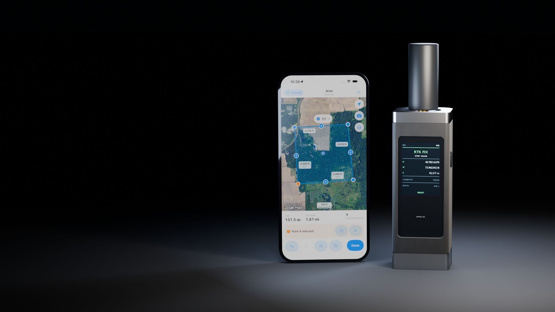
Open a compatible app on your phone. Pair Dipper Go over Bluetooth, or connect over Wi-Fi.
Use your existing compatible account, or choose a provider that covers your area. Add its connection details in the app.
Wait for a stable RTK fixed status, check the position estimate, then capture or mark points in the app.*
A correction service is separate from the receiver and may be free or paid. Check availability and fees in your work area. Learn about RTK ›
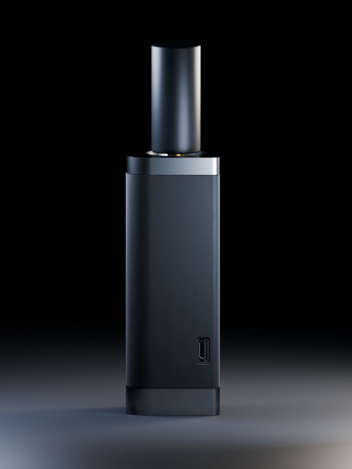
A handheld design with a screen for checking the connection and positioning status. The planned 5/8"-11 mount fits standard survey poles.
Concept render
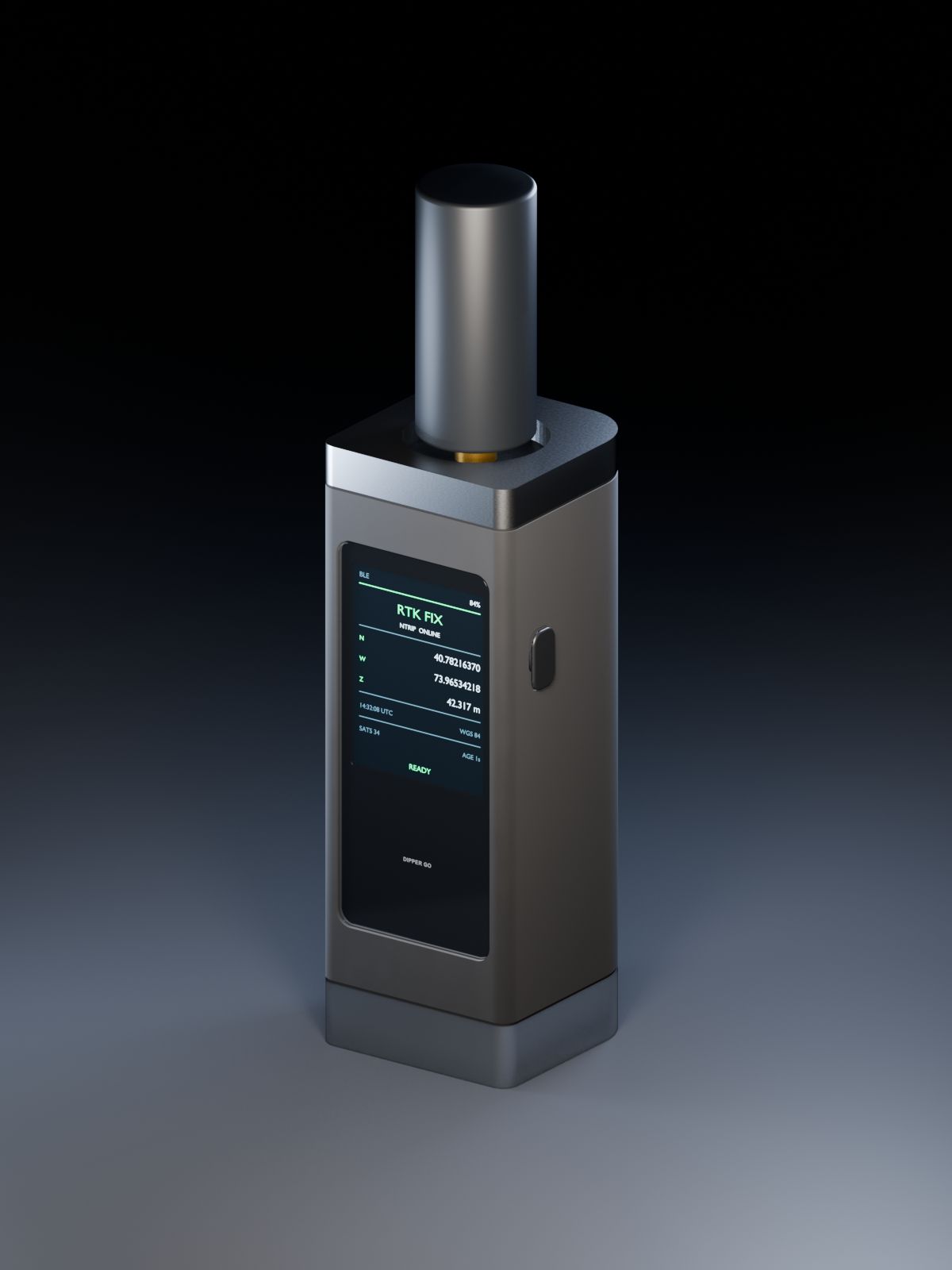
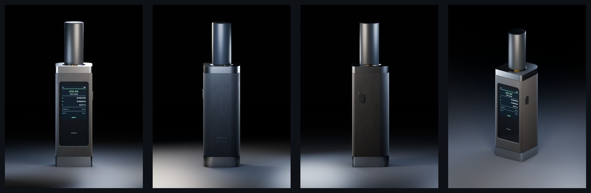
A rechargeable battery, a built-in satellite antenna, and Bluetooth or Wi-Fi connection to your phone. The specifications below separate design estimates from tested results.
Concept render
Dipper Go uses a multi-band satellite receiver. The figures below describe component ratings and design estimates, not finished-device field results.
4 bands
Tracks L1, L2, L5, and E6 signals.
6 constellations
GPS, GLONASS, Galileo, BeiDou, QZSS, and NavIC.
0.8 cm + 1 ppm
Horizontal RTK accuracy rating of the GNSS module.1
20 Hz
Up to 20 position updates a second.1
~15 hours
Estimated continuous RTK use on one charge, screen on.2
2 ways to connect
Bluetooth LE or Wi-Fi, to the phone you already carry.
Start with free Dipper apps, or use another app once its connection with Dipper Go has been verified. We are designing Dipper Go to work with third-party apps, with a tested list to follow before launch.
Dipper Go sends position data in the standard NMEA format over Bluetooth LE or Wi-Fi. Each app must support the connection and format. Here is what we have checked so far.
| App | Platforms | Connection | Status |
|---|---|---|---|
| Dipper Area Measure by InsightSpatial | iPhone, iPad, Android | Bluetooth LE, Wi-Fi | Connection tested |
| Dipper Field by InsightSpatial | iPhone, iPad, Android | Bluetooth LE | App coming soon; Go connection not yet tested |
| QField by OPENGIS.ch | iPhone, iPad, Android, Windows, macOS, Linux | Wi-Fi (NMEA over TCP) | Not yet tested |
A tested connection is not a completed field-accuracy test. Third-party compatibility is not confirmed; a full list will be published before launch. App names belong to their developers.
| Compare | Phone only | Phone + Dipper Go + RTK |
|---|---|---|
| Positioning | Usually within a few meters in open sky | Designed for centimeter-level RTK*; Dipper Go field results pending |
| Good for | Area estimates and approximate locations | Jobs that need more precise points, using a compatible app |
| What you need | Phone and app | Dipper Go, RTK service, internet connection |
Last updated:
| Status | In development |
|---|---|
| RTK accuracy | Horizontal 0.8 cm + 1 ppm, vertical 1.5 cm + 1 ppm (GNSS module rating1). Dipper Go field-test results to be announced. |
| GNSS | Quad-band: L1, L2, L5, and E6. GPS, GLONASS, Galileo, BeiDou, QZSS, and NavIC, with SBAS |
| Position updates | Up to 20 Hz (GNSS module rating1) |
| Time to RTK fix | About 5 seconds under open sky (GNSS module rating1) |
| Antenna | Multi-band GNSS antenna covering 1164–1290 MHz and 1570–1620 MHz, with a 28 dB low-noise amplifier |
| Mount | 5/8"-11 thread (standard survey pole) |
| Connection to phone | Bluetooth LE; Wi-Fi (NMEA over TCP) |
| Data output | Standard NMEA |
| Battery | 5,200 mAh (19.2 Wh), rechargeable lithium-ion |
| Battery life | About 15 hours of continuous RTK use with the screen on (design estimate2) |
| Size and weight | To be announced |
| Water and dust resistance | To be announced |
| App connections | Dipper Area Measure connection tested. Third-party apps are not yet verified; see App compatibility |
| Corrections | NTRIP (your own account or a network service) |
| Sales region | US first; other regions to be decided |
| Price | To be announced |
This device has not been authorized as required by the rules of the Federal Communications Commission. This device is not, and may not be, offered for sale or lease, or sold or leased, until authorization is obtained.
We only list what we can show. Updated as work moves forward.
Last updated:
We plan to launch Dipper Go in the US in the first half of 2027. The exact date depends on field testing and FCC authorization. Sign up for launch updates and we will email you when we set it.
In the US first. Other regions will be decided later.
Price will be announced before launch.
The receiver price includes its RTK function. Dipper apps are free. A compatible correction service is required for centimeter-level positioning and may be free or paid, depending on your provider. An InsightSpatial correction subscription is optional and is not yet available.
Yes. Dipper Go is designed to work with a compatible NTRIP correction account, including one you already use. Choose a service that covers your work area. You do not have to subscribe to InsightSpatial. We plan to offer our own service as an optional choice.
Our apps are free. We plan to keep on-device tools free, with charges only for optional online services such as cloud storage and RTK corrections. Area Measure is available now; Dipper Field and Dipper Layout are in development.
RTK corrections arrive over the internet. Satellite internet such as Starlink works. Without any internet connection, you will not get centimeter-level RTK positions.
Dipper Go is designed to connect over Bluetooth LE or Wi-Fi. An app must support the same connection and position-data format. The tested app list below will be updated before launch.
We are developing Dipper Go for compatible apps on iPhone, iPad, and Android. Area Measure has been tested for the connection shown below. Third-party apps still need verification; supporting NMEA alone does not guarantee compatibility. We will publish the tested list before launch.
We estimate about 15 hours of continuous RTK use with the screen on, from a 5,200 mAh battery. This is a design estimate from component power figures; we will confirm it in field testing.
No. Dipper Go is for measuring, layout, and record-keeping. It does not replace a licensed land surveyor.
Yes, once it is authorized and priced. Tell us what you need on our institutions page and we will follow up.
Get an email when Dipper Go has a launch date, a price, and field-test results.
This device has not been authorized as required by the rules of the Federal Communications Commission. This device is not, and may not be, offered for sale or lease, or sold or leased, until authorization is obtained.